

You can ask my host Susan, I was a bit worried about the weather the night before as I labored over the computer looking for a good potential route. The forecasts called for thunderstorms along my route of flight, but the radar indicated that these would be scattered and that I should be able to visually navigate around them. My intended route was through the Texas panhandle into Portales, NM along the New Mexico / Texas border. This was to be a perfect fuel stop since it was at the halfway point and the fuel price was quite reasonable. A quick look at the forecasts in the morning and at the current conditions and George and Susan brought me to the Northwest Regional airport. I decided that an early departure would be best, since the thunderstorm potentials increased as the day progressed, so I got up at 6am. I knew that as long as I could get through the panhandle and New Mexico early enough, I would minimize my exposure to the thunderstorms before they got the chance to feed on the sun's energy. Once I reached the Arizona / New Mexico border, I would be in the clear.
I had mentioned this plan to George the evening before, but Susan was asleep and didn't know of my early morning departure. Once I woke up and showered, I told George that I was ready at about 7am. He woke Susan up and she decided to come along, so she quickly woke up and prepared to leave with us. I can tell you that I didn't earn any brownie points for this short notice, but she understood that as a pilot, I had to go when the weather dictated.
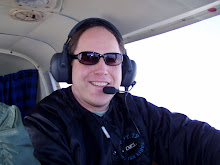
Once we arrived at the Northwest Regional airport in Dallas, I preflighted the airplane and packed my bags on board. George and Susan bid me farewell and waited by the truck to wave goodbye as I took off. Once airborne, I rocked my wings goodbye and I was off for Arizona, or so I thought. I quickly called up Dallas approach to request air traffic control services. It was at that moment that I realized that I could not find my cell phone. I panicked! My iPhone has been a critical component throughout this trip, as I am able to keep my website up to date, check my email, and check the weather no matter where I am. Also, all of my phone numbers and addresses were stored on the phone. I told Dallas approach that I would need to return to the field and quickly made a 180 degree turn. While returning to the field, I tried to determine what I should do, because I knew that George and Susan had probably already left and I neither had their phone number, nor a phone to call from! This was a real problem. I approached the airport anyway, and my mind reeled as I tried to come up with ideas to retrieve the cellphone. Just as I lined up for final on the opposite runway, I saw a pickup truck driving down the road near the airport. Luckily, it was George and Susan and they stopped on the road once they spotted me and began waving. I broke off my approach and quickly circled overhead the truck at a low altitude and tried to wave them back to the airport. I landed, and thankfully, they had gotten the message and returned in the truck. I felt incredibly lucky. I hopped out of the airplane and opened the back door to their truck where my cell phone sat. On the flight out to the airport, I had used the phone to call flight service to receive a weather briefing and in my haste to get started, I left it resting on the back seat. I was incredibly lucky to have seen them on the road and quickly retrieved the phone.
 I hopped back in the plane and took off, once again rocking my wings goodbye to Susan and George. What a story we would all have to tell about the lost cell phone. I called up air traffic control, and they remembered me from the previous launch attempt and began providing services. The plan was to navigate VFR to Portales and steer clear of the scattered thunderstorms that may await. This route was relatively uneventful, but I deviated to the North to steer clear of building rain showers, utilizing a valuable resource available to pilots for many decades, Flight Watch. This service involves a trained weather briefer who can provide real-time updates concerning the ever-changing weather situation. Portales was in the clear and I was able to land and refuel there.
 The next segment of the flight would be the most challenging VFR flight segment I have ever flown. My goal was to fly from Portales, NM to Socorro, NM and then onto Winslow, AZ. This route was established based on looking at a radar image on the ground in Portales. I had been relying on Flight Watch on the frequency 122.0 to provide me with weather updates since I did not have an on board weather device to be able to view the radar. I really must commend Flight Watch for not only providing me with accurate and up to date weather, but also for their recommendations concerning deviations, keeping me out of the worst of it. During this phase of flight, I did encounter a stretch where I was pushed lower and lower due to the cloud cover. At one point, I was skimming along the desert at 500 feet. The desert was relatively flat, but there were terrain features I had to be mindful of. While it may sound like I was flirting with danger, I always maintained an exit strategy. I would push ahead, always being certain that the path to the airport behind me was good. There was one point where I had considered turning around, but even though I was low, I could see well ahead of me across the flat desert floor. There were a few bumps I had to navigate around, but finally, the ceiling lifted, and I was able to climb again.
At one point, I had a rather large cell on my left side, and I could see cloud to ground lightning. This was a little unsettling, but I kept a good distance away from it, and the path ahead and to my right was good. Also, I was only about 10 miles outside of Socorro when I noticed two rain shafts developing ahead of me both to the left and right. Between them was a clear spot where I could still see the city ahead. I was navigating for this opening, when the showers merged and became an impenetrable line of heavy rain. It was amazing to see weather develop right before my very eyes. I turned to the north and contacted Flight Watch again for some guidance. They could see the showers I had just encountered as well as other storms ahead, but they gave me a routing that they thought should keep me in the clear. Indeed, their route worked flawlessly and kept me to the North of the worst weather. As I crossed into Arizona, I breathed a sigh of relief because I knew that good weather was ahead. The skies cleared and nothing but Arizona sunshine awaited me.
Years ago, as my friend Pete and I listened to the Eagles song "Take It Easy", we talked about buying Harleys and riding them out to Winslow, AZ so that we could stand on a corner. The thought stuck with me and I knew that I had to make Winslow a stop on this trip. I landed at the Winslow airport and despite having a staffed FBO, I was one of only two airplanes at the entire airport. This was a harbinger of what I later encountered in town. Luckily, the FBO had a crew car that I could borrow. It was an early 80's station wagon that just barely ran, but it was good basic transportation.
 Just about the only thing you can do in Winslow is visit "Standin' on a Corner" park, which a consortium of businessman developed in 1999. In paying homage to the song that put Winslow on the map, this park features a two story brick facade with a mural depicting a girl in a flatbed Ford slowing doing to take a look at me. It also features a bronze statue of a 1970's man standin' on a corner, leaning up against a lamppost. Several tourists stopped by and I had one take my picture and served as photographer for a while, taking other folks' photos to commemorate their visit to this famous spot. After entering some of the souvenir shops located at this corner, I realized that I was on historic Route 66! I bought a Route 66 mug.
I asked the locals where the best place to have lunch is, and each time, they looked at the clock. Well, it wasn't 5pm yet, so that actually couldn't recommend a place. The only place that serves decent food is the La Posada Inn, and their kitchen doesn't open until 5pm. I didn't have time to wait, so I drove towards the interstate where I found a Denny's. I took half of my tuna melt with me and headed back to the airport.
Upon takeoff, I got to experience the next big challenge of my trip: Density Altitude. This can be just as deadly as a thunderstorm if you don't understand it and don't follow procedure. First, let me explain what Density Altitude is and how it is calculated. It is computed by taking your actual altitude and factoring in the effects of temperature and pressure. For aviation, the standard pressure is 29.92 inches of mercury and the standard temperature is 15 degrees C or 59 degrees F. When the pressure is lower and/or the temperature is greater, there are less air molecules present at any given altitude, and to the airplane, it feels as if it is actually at a higher altitude than actual. The higher the altitude, the less air molecules. Less air means less oxygen and power for the engine and less lift for the wings. So, the higher you go, the less performance an airplane has. Finally, you reach an altitude called the service ceiling in which the airplane will no longer produce a sufficient climb. You have reached the limit of that particular airplane. I can tell you that in the high desert, I reached the absolute limit of my airplane. At high density altitudes, the airplane demonstrates a very anemic climb profile. It may just barely climb. This means that you could take off out of a high elevation airport and skim along the surface at 100 feet for over a mile before gaining any significant altitude. It is this shallow takeoff performance that presents danger.
The Winslow airport is at 4941 feet, the highest airport I had dealt with throughout the trip to date. In the hot desert sun, however, the density altitude was about 8000 feet, a place where my aircraft's performance is not that great. You don't really notice it on landing, because gravity is doing all the work in terms of negative altitude change. You sit up and take notice when you takeoff in these conditions, however. Despite having a lengthy 7000 foot runway, I noted a very shallow climb profile and wondered when I was going to gain some altitude. I wasn't worried though because I took off over a relatively flat desert floor, so there was nothing to hit, and i could have landed on the desert floor easily if there was an issue. I finally was able to pick up some altitude and made my way to 10,500 feet. My airplane was woefully underpowered in this high, hot desert, but there were no real obstacles to speak of until I got closer to Sedona. There was, however, I very interesting geological feature.
 This was a feature I had planned to see, but actually forgot about as I was departing Winslow. Luckily, I caught it out of the corner of my eye and flew over to have a closeup look. This was Meteor Crater. This crater was formed 50,000 years ago by a meteorite that was only 50 yards across striking the earth at almost 30,000 miles per hour! The crater is about a mile across and over 500 feet deep and is privately owned. I wouldn't have wanted to be around when that rock fell out of the sky! Its a darn good thing I didn't fly into the crater for a closer look. This from Wikipedia: "On August 8, 1964, a pair of commercial pilots in a Cessna 150 flew into the crater for a closer look but were unable to climb out due to downdrafts. They ended up circling the interior until their fuel was exhausted and crash-landed. They survived their ordeal and a small portion of the wreckage not removed from the crash site remains visible to this day."
 Many of my pilot friends told me that I absolutely had to land at the Sedona airport, and I immediately understood why once I pulled into the area. Sedona is this beautiful town that lives in the shadow of tall red rock formations. In the center of town is a huge mesa whereupon the airport sits. It is an absolutely stunning site and was the most amazing geological and aviation site I had ever seen! Since Sedona was not my final destination, I made the wise decision not to land there. Instead, I took in its beauty from 10,500 feet. I knew that had I descended into Sedona, I would have only had to fight my way back to the precious altitude I had fought so hard to achieve.
  I would circle the Sedona airport at altitude and then turn to the north to reach my final destination for the day: Flagstaff, AZ. This would end a 9+ hour flying day. I was absolutely exhausted and my body ached from sitting in the cramped cockpit all day long.
The FBO in Flagstaff called a cab which brought me into downtown Flagstaff to a place called the DeBeau Hostel. I had done my research online and there were two hostels: DeBeau and the Grand Canyon Hostel. I don't know why I decided on this one, but I made the right choice. DeBeau was very clean and maintained an extremely
 friendly atmosphere. I knew it was perfect for me the moment I walked in the door. Yes, you can save a lot of money staying at a hostel if you don't mind bunking in dormitory-style rooming, but I can't tell you how many interesting folks I meet at a place like this. For $20 / night, you get a place to sleep, free Internet, a full shared kitchen, a nice living room area to relax in, and plenty of unique and friendly people to talk to, many of which are young travelers from all over the world! After signing in at the front desk, I was immediately invited to join in on a barbecue party and was served hotdogs and hamburgers. A group of school kids from Virginia were there and
  their chaperones announced to the kids that I was flying around the entire US. The kids thought that was pretty amazing and began asking questions. Next, the hostel staff began bringing out salads, corn, and more burgers and dogs and had a barbecue of their own. I was fed quite well, a welcome surprise after such a long and arduous day of flying.
Finally, the school group was winding down in the game room and I began showing them some card tricks. The look of astonishment on their faces demonstrated that I was really pulling off my illusions successfully. Normally, I won't repeat a trick, because if you do it a number of times, someone will ultimately catch on and destroy the wonder, but each kid wanted me to do a few particular tricks for them, so I ended up doing the tricks over and over and they worked every time. They were thrilled to be entertained and I was happy to share my magic with them. My only problem was exhaustion. I began the day at 6am, and had flown 865 miles in one day!! I could barely stand after I completed the card
 tricks, so I sat down with my computer for a while and headed off to bed. The next day would present more density altitude challenges and I would experience one of most awe inspiring moments of my entire life: my first glimpse at the Grand Canyon!
I'm enthralled by your blog and look forward to each installment. It's great to hear that you've been able to reconnect with old friends and that you're having a blast wherever you go. Please take care of yourself, and blue skies for the duration of your trip!
ReplyDelete