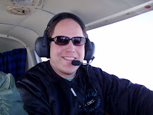
On Friday, I will be flying to Long Island to see Pete Spaeth's daughter Veronica perform in Les Miserables. I will be leaving Hudson Valley Community College promptly at 4pm, driving to the airport by 4:15pm and taking off by 4:30pm. The flight will take approximately 1hr 15mins, so I should be airborne from 4:30pm - 5:45pm on Friday. I will be testing the GPS tracking through the blog, so if you load up the page, you should see me flying on the map in real time. If you click on the image of my airplane, it will bring up a much bigger map. Unfortuntely, it doesn't update automatically, so if you want to refresh my position, you will have to hit refresh on your browser. Try it out and see if it works for you.
I have also added two maps at the bottom of the page. For now, I have added a rough cut for my proposed route. It will run clockwise, starting on the east coast first. As I refine the route over the next several weeks, I will be updating that map. Below it will be the actual route flown. This will get updated based on the actual airports I land at along the way. Once the plan is in place, I don't expect too many changes, but on a trip like this, one should expect the unexpected I suppose. These maps are important so that you can really get a sense of the locations I'll be flying to within the US. I'll spend most of my time along the periphery of the country.
So, if you're bored on Friday, load up the page and track me live to Long Island.
T minus 40 days and counting.
Wednesday, April 22, 2009
Subscribe to:
Post Comments (Atom)

No comments:
Post a Comment